
Can a drone as first responder program really work? Emergency responders have a new set of eyes in the skies - drones! Unmanned aerial systems (UAS), or drones, are transforming how agencies like police, fire departments, and emergency medical services approach response calls. Drones provide a unique aerial perspective that delivers real-time intelligence to guide critical decisions when every second counts. Read on to learn how drones as first responders are saving lives through faster response, strategic data, and advanced capabilities.
Key Takeaways:
- Drones give emergency responders an overhead view and live video to assess situations faster. This aerial perspective enables better response time and preparedness.
- Advanced drone features like AI, autonomy, thermal imaging improve search, rescue, and mapping capabilities. They also reduce risks to human responders.
- Proper training and qualified drone pilots are essential for operating UAS safely and effectively. Agencies develop specialized programs to leverage drones.
- Drone first responder programs have already demonstrated faster emergency response, better outcomes, and enhanced safety in communities using them.
- As drone tech advances, it will continue transforming how agencies plan for and manage emergencies of all types in the future.
The Power of Drones for Public Safety Agencies
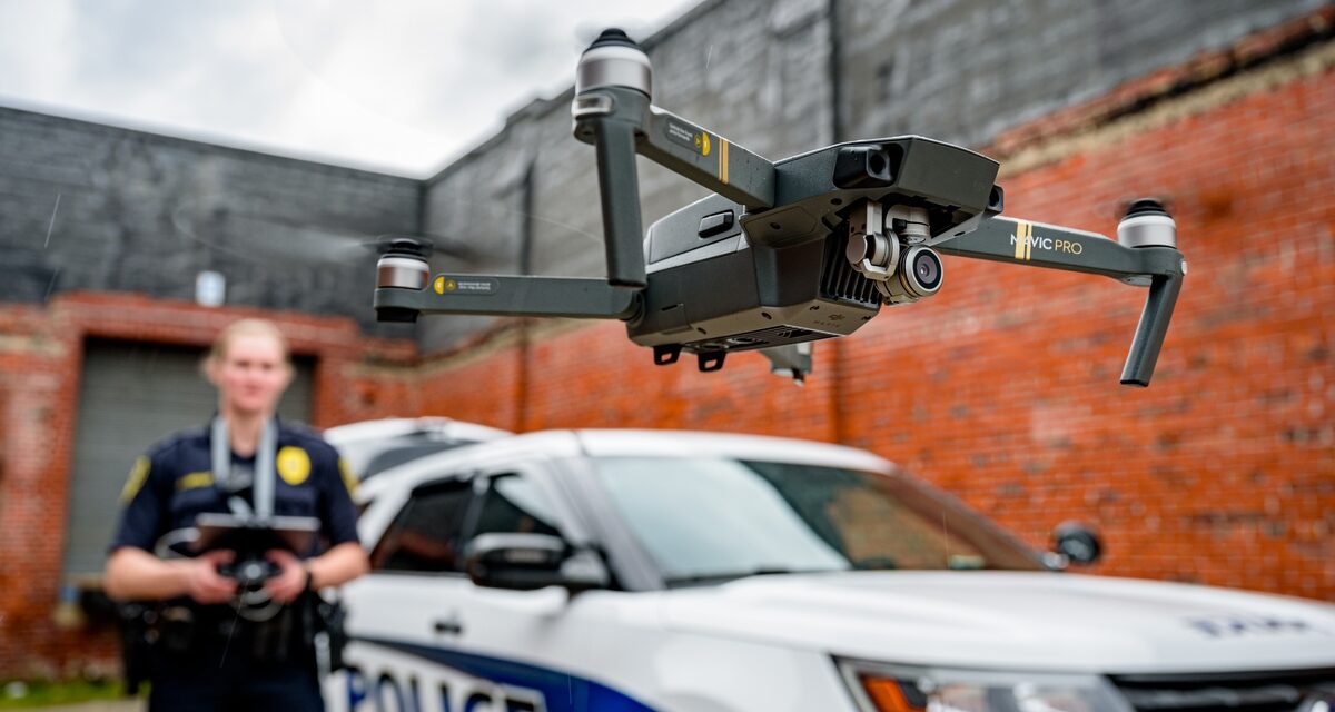
Drones provide a vantage point and mobility unmatched by any other means. These unmanned aerial vehicles (UAVs) give emergency responders an invaluable eye overhead within minutes.
For police, drones mean getting a live video feed and observations from a crime scene or traffic accident before officers even arrive. Firefighters can use drones to identify hotspots and assess the scale and progress of a wildfire disaster faster. Emergency medical teams can locate lost hikers or avalanche victims more efficiently with thermal drones.
Drones essentially function as first responder force multipliers. They provide critical air support that enhances:
- Situational awareness - Assess emergency scenes in real-time from a safe aerial view
- Search capabilities - Scan wide areas quicker and with greater detail
- Mapping - Rapidly map disaster damage, structural fires, accident sites
- Response time - Reach emergencies faster than ground units
- Safety - Reduce risks to responders by scouting unsafe areas first
With this bird's eye view and tactical intelligence, responders have more information to respond appropriately, allocate resources efficiently, and save lives.
Real-Time Aerial Perspective and Intelligence
During emergencies, timely information is everything but often in short supply. Drones give responders an instant overview of the situation from above.
Equipped with high-resolution video cameras and sensors, drones can provide crucial details in real-time:
- The scale of damage and infrastructure impacted in a natural disaster
- The extent and source of a hazardous chemical leak
- The proximity of victims and viability of access points in a structural collapse
- The presence of armed suspects and visibility for officers approaching a crime scene
This aerial information aids responders in coordinating the fastest and safest response. It also reduces the unpredictability that emergency personnel often face.
With software integrations, drone video feeds and sensor data can be shared instantly with officers on the ground and command centers. This builds a common operating picture invaluable for strategic response.
Some police departments even utilize live video streams from 911 callers before officers arrive on scene. This further closes the intelligence gap between an emergency call and response.
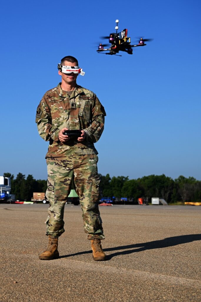
Critical Role of Drone UAS Mission Pilot Training
While drones provide amazing capabilities, the human element remains critical. Responder agencies must have trained and qualified personnel to leverage drones effectively.
Specialized drone pilot training ensures UAS operations are safe, skilled, and maximize benefits for emergency services.
FAA Regulations for Safe and Effective Drone Operations
The Federal Aviation Administration (FAA) regulates all drone flight to ensure safety and accountability. To legally fly drones for emergency response, pilots must obtain a Remote Pilot Certificate by passing the FAA Part 107 test.
This covers essential aviation concepts like airspace restrictions, weather impacts, and operating rules. It sets a standard for proficient, responsible drone use.
Responders must also apply for operational waivers from the FAA to expand their drone capabilities for emergency scenarios. Common waivers include permission to:
- Fly multiple drones simultaneously under a single pilot
- Operate drones beyond visual line of sight
- Conduct drone flights at night
- Exceed standard speed and altitude restrictions as needed
Obtaining these waivers enables more flexible and capable drone operations. For example, rapidly deploying a coordinated fleet of drones at night after a natural disaster to map damage across a wide area. Standard Part 107 rules alone would severely limit this capacity.
Qualified Pilots Maximize Drone Potential
Beyond base FAA requirements, trained public safety drone pilots:
- Learn to maneuver different drone models in complex environments
- Master coordinating with ground response units during high-stress incidents
- Maintain composure and make quick judgments for safety
- Troubleshoot technical issues that may arise in flight
These specialized skills allow pilots to adapt drones to dynamic emergency situations.
With proper training, drone pilots become extremely capable tactical operators. They leverage aerial data to guide “boots on the ground” for faster, smarter emergency response.
Drone Manufacturers Tailoring Solutions for First Responders
Drone companies recognize the huge potential of UAS technology for public safety agencies. Many leading manufacturers now offer drone systems built specifically for first responder needs.
Autonomous Drones with AI for Enhanced Capabilities
Consumer drones rely heavily on pilot input to control their movement. By contrast, many public safety drones integrate cutting-edge autonomy and AI:
- Autonomous flight - Pre-programmed to fly any mapped area or route without active navigation
- Automated takeoff/landing - Takeoff and land reliably without pilot assistance
- Object avoidance - Detect and maneuver around objects in flight path without pilot direction
- Enhanced stability - Maintain steady, efficient flight in windy and turbulent conditions
- AI integration - Automate camera, sensor, and payload controls based on environmental inputs
These automated features allow drones to operate easily in challenging emergency environments. They also give pilots more mental bandwidth to focus on the mission objectives.
The latest drones even utilize computer vision and deep learning to analyze images, map terrain, and support decision-making. This artificial intelligence amplifies the data gathering and analytical capabilities.
Did You Know: Drones are being used to deliver life-saving medical supplies to people in remote or inaccessible areas. For example, the company Zipline is using drones to deliver blood, vaccines, and other essential medical supplies to remote villages in Rwanda. Zipline's drones can travel up to 63 miles per hour and deliver supplies within 45 minutes of receiving a request.
Rugged, Reliable Drones Built for Challenging Environments
Public safety drones are specifically engineered for demanding emergency response missions:
- All-weather airframes resistant to rain, snow, wind, dust, and temperature extremes
- Redundant motors and flight systems prevent single-point failures
- Backup batteries extend operational flight time as needed
- Larger payload capacity suits multiple sensors and gear
- Encrypted digital data links keep drone control and video feeds secure
By maximizing reliability and performance, purpose-built responder drones excel in tough conditions where consumer UAS struggle.
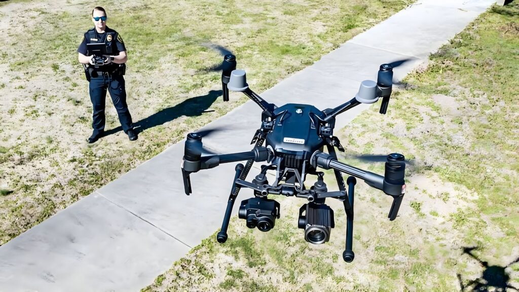
Leading models for emergency services include:
- DJI Matrice 300 RTK - rugged autonomous drone with AI integration
- Skydio 2 - obstacle avoidance and precision navigation in dense environments
- Yuneec H520 - stable, all-weather commercial drone with ample battery life
- Teledyne FLIR SkyRanger - highly maneuverable drone resilient to GPS loss and interference
Drone as First Responder Programs Saving Lives
Pioneering public safety agencies have adopted Drone as First Responder (DFR) programs over the last few years. These departments deploy drones from strategic locations across their jurisdiction to beat ground units in responding to emergencies.
The results make a compelling case for the life-saving potential of UAS technology.
Faster Emergency Assessment and Disaster Mapping
During disasters like earthquakes or floods, drones provide near-instant aerial situational awareness. This allows emergency managers to promptly identify and map:
- Hardest hit zones
- Destroyed roads/bridges
- Damaged critical infrastructure
- Buildings at risk of collapse
With this rapid damage assessment from drones, aid and resources can be directed where most urgent.
After the 2015 Nepal earthquake, drone mapping expedited search and rescue efforts. Drones also located survivors days after the 2017 Mexico City earthquake.
Improved Search and Rescue Capabilities
Drones augment search and rescue operations through:
- Covering wider physical areas faster
- Reaching dangerous or inaccessible terrain
- Conducting grid searches for victims
- Low-light and thermal cameras effective at night or in dense cover
These expanded capabilities increase the chances of finding lost or missing people in time during disasters. Drones have already directly saved hiker and avalanche victims.
Did You know: Drone lifeguards are saving lives on Spanish beaches. In one recent incident, a drone dropped a life jacket to a 14-year-old boy who was struggling to stay afloat in a strong current. The boy was rescued and sent to the hospital, but was released after 24 hours.
Better-Informed and More Strategic Response
With real-time aerial views, responders gain invaluable perspective and insights prior to even reaching chaotic emergency scenes.
Police can identify armed subjects and strategic positioning to contain dangerous situations and de-escalate more safely. Firefighters see hotspots to direct water drops and contain spread efficiently. EMTs pinpoint victim locations and hazards blocking access.
In Chula Vista, California, the police department's DFR drones arrive 5-7 minutes before officers on average. This live aerial intel informs smarter response and containment upon arrival. It also reduces reliance on force due to improved situational awareness.
The Future of Drones in Emergency Services
Drone adoption in emergency response is still in its early stages, but innovation will continue expanding UAS capabilities.
Advanced AI and Autonomous Functionalities
With artificial intelligence (AI) research accelerating, drones will gain more sophisticated automation and analytical features.
Autonomous swarming allows a single pilot to control coordinated movements of multiple drones. This amplifies searching and mapping capabilities over a large area.
AI image analytics can automatically classify objects and detect changes in video feeds. For example, identifying pending structural failures and escalating risks after an earthquake. This context aids human decision-making.
Swarm Drone Technologies for Expanded Operations
Swarming involves multiple drones autonomously networking and collaborating. This can revolutionize emergency response:
- Deploy swarm clusters rapidly over a disaster zone
- Create expansive ad-hoc communication networks for responders
- Dynamically optimize swarm distribution as needs shift
- Coordinate autonomous flights for efficient area coverage
- Share sensor data between drones for comprehensive monitoring
Swarm networks amplify air support at large emergencies significantly.
Developing Standards for Widespread Adoption
Public agencies often delay adopting new technologies until formal standards exist. This ensures continuity of operations, equipment, training, and more as personnel turns over.
The National Institute of Standards and Technology (NIST) is leading development of drone standards for public safety agencies. These will cover:
- Airspace integration and compliance
- Pilot training requirements
- Data security, access, and retention policies
- Equipment procurement guidelines
- Maintenance and upgrade protocols
- Liability best practices
With public safety drone standards, agencies nationwide can more easily and confidently launch UAS programs. This will make drones ubiquitous among first responders.
FAQs
How are drones controlled as first responders?
- Drones can be piloted manually but most public safety models have intelligent autonomy. This allows pre-programming flight routes and automation based on environmental conditions. The drone flies itself on a mission while the remote pilot monitors the cameras and sensors.
Can anyone operate drones for emergency response?
- No. Due to aviation safety regulations, drone pilots must be FAA certified. Public safety agencies require further specialized pilot training for their drones and missions.
Do police need a warrant to use drones?
- If conducting targeted surveillance of individuals, yes generally a warrant is required. For emergency response, no as long as drones follow departmental policies against invasive surveillance practices.
How long can drones fly as first responders?
- Flight duration depends on the model, but most public safety drones range from 15 minutes to over an hour. Backup batteries can double flight time as needed. Tethered drones with continuous power can fly for days.
How does weather impact first responder drones?
- Severe weather presents hazards, but public safety drones are engineered to withstand rain, wind, dust and temperature extremes. Limitations depend on the specific model and conditions.
Can drones be equipped with weapons or lethal force?
- No. Current FAA regulations prohibit weaponizing drones and this is not contemplated for emergency responders. Drones provide information-gathering capacity, not force options.
Do first responder drones record data?
- Yes. Drone cameras and sensors typically record video and telemetry data. This is stored by the operating agency under existing evidence handling policies and public records laws. Specific retention regulations depend on the jurisdiction.
What measures are in place to protect privacy with the police drone program?
- Multiple measures ensure privacy is protected with the police drone program. Drone operators undergo background checks and extensive training on privacy rules. All drone data is securely stored, audited, and subject to public records laws. Drones are only launched for specific calls, not routine patrols. And they are focused only on areas relevant to the call, without invading private spaces. The program's priority is upholding public safety and the law, not impinging on reasonable privacy expectations. With oversight and judicious use, drones enhance safety without compromising rights.


